Strategic Flood Reduction Priorities

Download Document

Purpose and Process

The Strategic Flood Reduction Priorities (SFRP) documents the North Houston Association’s (NHA) recommendations for priority flood reduction projects and strategies. This provides a starting point, by watershed, for advocacy and education to members, legislators, and the public within NHA service area. NHA representatives met with more than 25 agencies and organizations to gather their top priorities within the NHA service area. Priorities were included in this plan because they provided regional benefits and scored well using the following criteria: Achievability, Flood Mitigation, Diversity,  Multipurpose/Function, Floodplain Restoration, Flood Reduction Benefits to Frequently Flooded Areas and Critical Facilities.

General Strategies

In addition to the watershed specific items below, general strategies were identified that can reduce flood impacts such as: master drainage planning, floodplain preservation, education, flood mapping, flood response planning between communities, flood warning systems, and use of comprehensive benefits in project evaluation and selection.

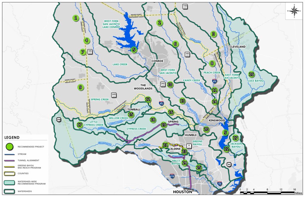
Project Specifics by Watershed

Caney Creek (2, 6, & 14)

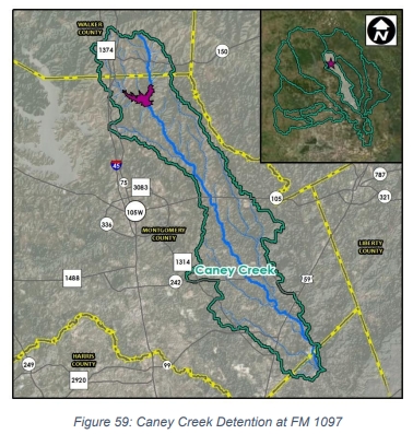
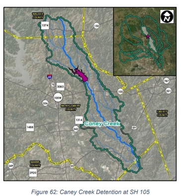
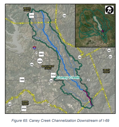
Two large dry dam detention facilities in the upstream areas of the watershed near FM 1097 and SH 105 will collectively create approximately 42,000 acre-feet of stormwater detention to significantly reduce the risk of flooding for these areas. This is coupled with channel conveyance improvements (and appropriate stormwater detention mitigation) in the downstream area at I-69.

Cypress Creek (18 &19)

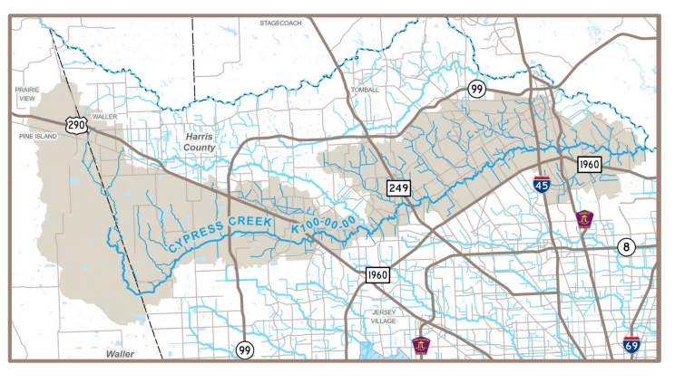
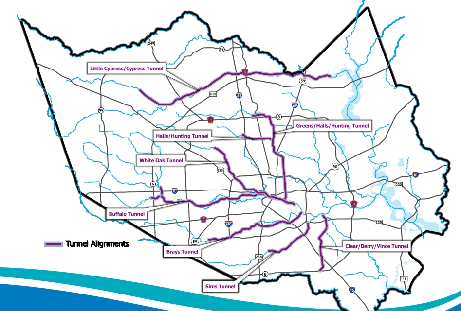
The Cypress Creek Implementation Plan recommends the construction of 14,000 acre-feet of stormwater mitigation volume throughout the watershed using primarily existing public rights-ofway. A proposed stormwater conveyance tunnel would divert extreme event flows underground directly to Lake Houston. During these same extreme events, water from Cypress Creek overflows the watershed and flows north to Addicks and Barker Reservoirs. Study and Management of this overflow to the extent possible is crucial to all three watersheds.

East Fork San Jacinto River (3)

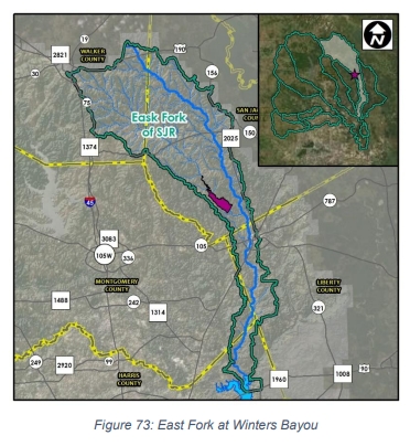
A large dry dam on Winters Bayou, a tributary of the San Jacinto East Fork, will create 45,000 acrefeet of stormwater detention, reducing the risk of flooding for Cleveland and Plum Grove.

Greens Bayou (21 & 23)

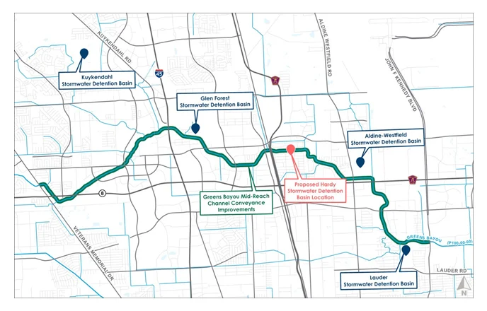
The Greens Bayou Mid-Reach Program, which has been in development and construction for more than 20 years, includes 11 miles of channel conveyance improvements and six large regional stormwater detention basins. Additionally, a proposed stormwater conveyance tunnel would divert extreme event flows underground directly to the Ship Channel by way of the proposed Halls and Hunting Bayous tunnel.

Halls Bayou (24 &25)

The current HCFCD Bond Implementation in Halls Bayou is Phase 0 of a long range vision plan for the watershed. A new start of a previously discontinued USACE study using current and updated guidance could lead the way to significant federal investment in flood risk mitigation in the watershed. A proposed stormwater conveyance tunnel would divert extreme event flows underground directly to the Ship Channel by way of the proposed Hunting Bayou tunnel.

Jackson Bayou (27)

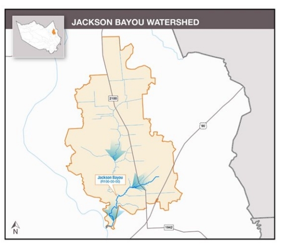
Numerous projects were identified for Jackson Bayou flood risk mitigation in a recently completed watershed plan, including a combination of channel conveyance improvements and stormwater detention mitigation.

Lake Conroe and Lake Houston (5)

Develop a joint reservoir operations and communications strategy for Lake Conroe and Lake Houston, with the goal of establishing efficient and safe operation of the two reservoirs once additional gates are constructed at Lake Houston.

Lake Creek (1, 4 & 7)

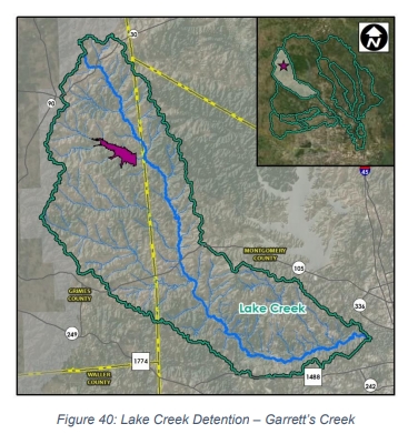
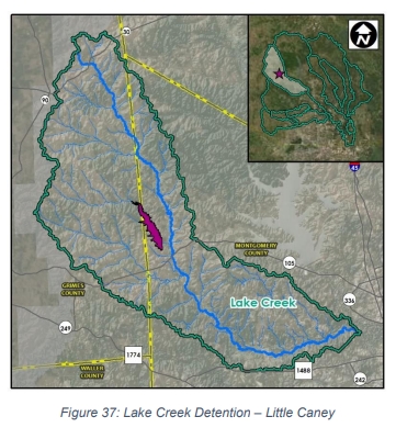
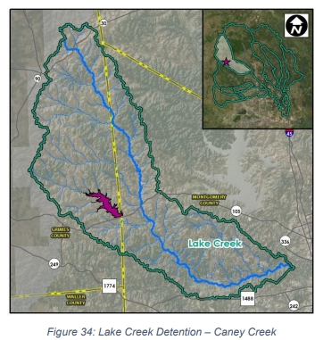
Create more than 52,000 acre-feet of stormwater detention in the Lake Creek watershed through the construction of three different dry dam facilities on Caney Creek, Little Caney Creek and Garrett’s Creek.

Little Cypress Creek (17)

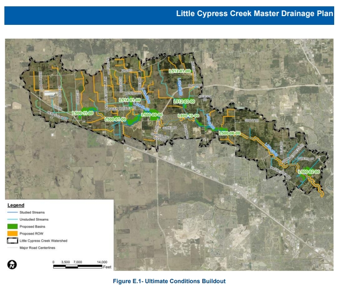
The Little Cypress Creek Frontier Program establishes clear roles and responsibilities for the orderly development in the Little Cypress Creek service area to promote construction of flood risk reduction features and cost-effective long term maintenance. As the area continues to rapidly develop, continued collaboration with land owners and developers is encouraged to maximize stormwater mitigation and water quality, as well as opportunities for public recreational amenities and open space. The program is highlighted by nine regional stormwater detention basins and channel conveyance along Little Cypress Creek and its tributaries.

Luce Bayou (26)

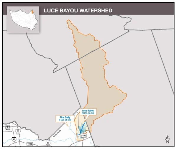
Luce Bayou spans Harris, Liberty, and San Jacinto Counties and has a broad mix of developed areas as well as wide areas that are undeveloped. Since flooding does not follow political boundaries, collaboration between these three counties is encouraged. Opportunities for private/public partnerships may also prove beneficial as areas begin to develop.

Peach Creek (8 & 11)

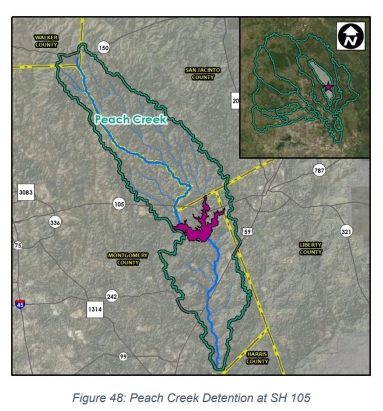
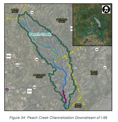
Two large dry dam facilities will establish 72,000 acre-feet of stormwater detention on Peach Creek upstream and downstream of SH 105. Additionally, channel conveyance improvements, with appropriate stormwater detention mitigation, are needed on Peach Creek between I-69 and the confluence with Caney Creek. All in these facilities will reduce the risk of flooding for Wood Branch, Patton Village, Splendora and Roman Forest.

Spring Creek (9, 12 & 16)

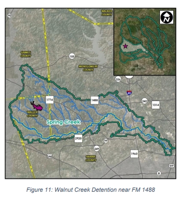
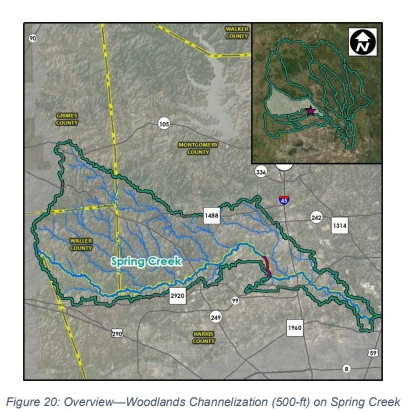
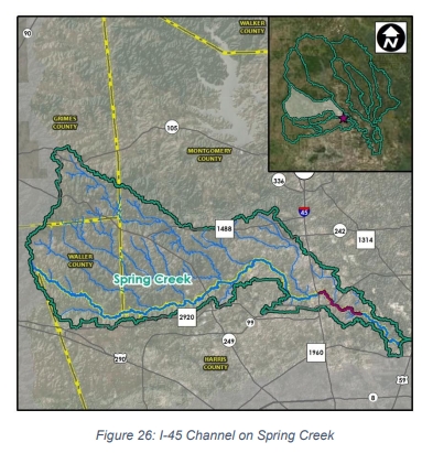
Dry dams on Walnut Creek and Birch Creek to create large stormwater detention basins are being considered individually and in combination to benefit Spring Creek. Channel conveyance improvements, with appropriate stormwater detention mitigation, is recommended on Spring Creek from Willow Creek to Kuykendahl, as well as from I-45 to 4 miles downstream of Riley Fuzzel.

West Fork San Jacinto River (10, 13, 20 & 22)

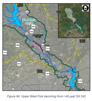
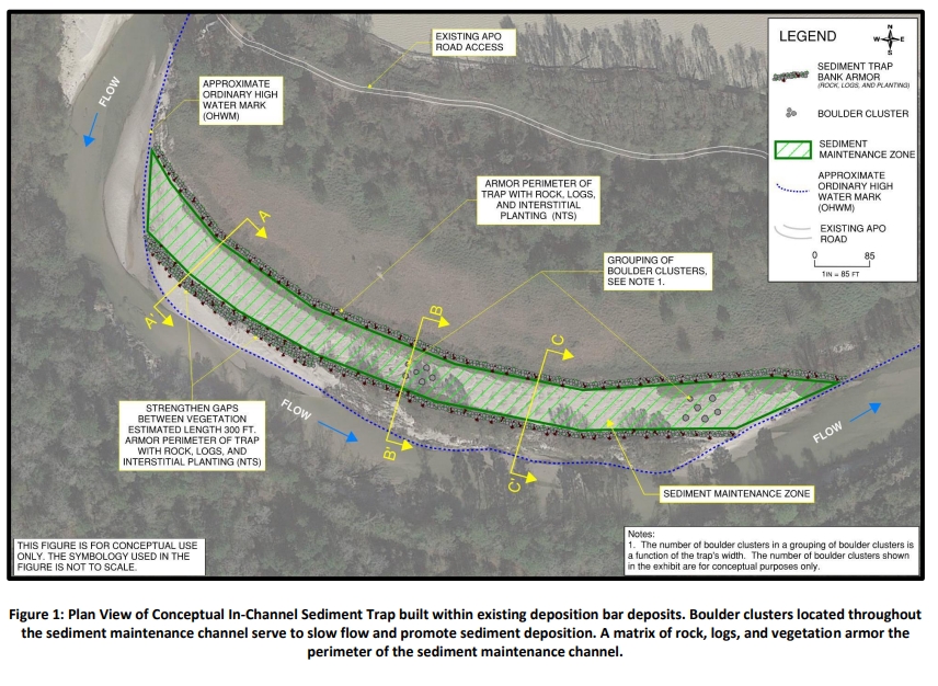
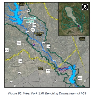
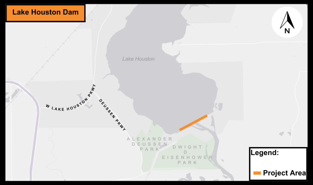
Coupled with appropriate stormwater detention mitigation, channel conveyance improvements on the Upper West Fork from I-45 to SH 242 and channel benching from I-69 to West Lake Houston Parkway, will bring much-needed flood risk mitigation to River Plantation and Kingwood respectively. A pilot “sand trap” project hopes to reduce future sedimentation accumulation downstream into Lake Houston. And the City of Houston and Coastal Water Authority are partnering to add additional gates to the Lake Houston Dam which will allow greater flexibility with pre-emptive lowering of the lake in advance of a flood as well as provide greater flexibility in operational collaboration with Lake Conroe.

Willow Creek (15)

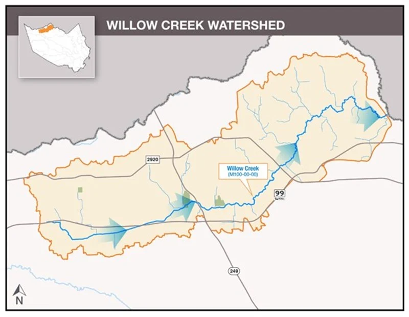
Nine areas along Willow Creek totaling almost 900 acres have been identified for possible regional stormwater detention basins. Acquiring and excavating these basins will significantly reduce the risk of flooding throughout the watershed. Acquiring approximately 450 additional acres for floodplain preservation and maintenance access is also encouraged.

Projects & Program Details

1: Lake Creek

Garrett’s Creek Stormwater Detention Basin

Click For More Project Information

2: Caney Creek

Stormwater Detention Basin at FM1097

Click for More Project Information

3: East Fork San Jacinto

Winters Bayou Dam and Stormwater Detention Basin

Click for More Project Information

4: Lake Creek

Little Caney Creek Stormwater Detention Basin

Click for More Project Information

5: Lake Conroe

Joint reservoir operations with Lake Houston

Click for More Project Information

6: Caney Creek

Stormwater Detention Basin at SH105

Click for More Project Information

7: Lake Creek

Caney Creek Stormwater Detention Basin

Click for More Project Information

8: Peach Creek

Stormwater Detention Basin at SH105

Click for More Project Information

9: Spring Creek

Walnut Creek & Birch Creek Stormwater Detention Basin

Click for More Project Information

10: West Fork San Jacinto

River Plantation Channel

Click for More Project Information

11: Peach Creek

Channelization at I-69

Click for More Project Information

12: Spring Creek
13: West Fork San Jacinto

Sediment Removal and Sand Trap Development

Click for More Project Information

14: Caney Creek

Channelization at 1-69

Click for More Project Information

15: Willow Creek

Willow Creek Watershed Plan

Click for More Project Information

16: Spring Creek
17: Little Cypress Creek

Little Cypress Creek Frontier Proqram

Click for More Project Information

18: Cypress Creek

Cypress Creek Implementation Plan

Click for More Project Information

19: Cypress Creek

Cypress and Little Cypress Creek Tunnel

Click for More Project Information

20: West Fork San Jacinto
21: Greens Bayou

Greens Bayou Mid-Reach Program

Click for More Project Information

22: West Fork San Jacinto
23: Greens Bayou
24: Halls Bayou
25: Halls Bayou

Halls Bayou Vision Plan and Federal Study

Click for More Project Information

26: Luce Bayou

Interagency Coordination

Click for More Project Information

27: Jackson Bayou

Jackson Bayou Watershed Plan

Click for More Project Information